top of page
Univerus Assets Logo
Faraway shot of cityscape next to the water to represent Univerus Assets GIS integration to visualize your city in real time

GIS Integration

Your City, Visualised in Real Time

Watch every road, pipe, park, and street-light come to life on an interactive map that makes infrastructure easy to understand—and even easier to keep running smoothly.

City Data at Your Fingertips

Univerus Assets turns complex infrastructure data into a simple visual that helps crews respond faster, lets residents understand where tax dollars go, and keeps your community running smoothly.

What GIS Integration can do

  • One Click to Locate Anything

    Find the exact spot of a water valve, a broken bench, or a blocked drain—no more guesswork or paper maps.
     

  • Colour-Coded Health Indicators

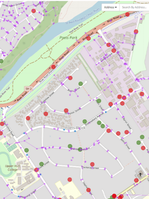
    Green is good, yellow needs attention, red means act now. It’s that simple.
     

  • Instant Work Requests

    Tap a problem on the map and create a maintenance ticket in seconds. Crews see the same location and drive straight there.
     

  • Smart Routes for Crews

    The system groups nearby jobs together, saving drive time, fuel, and taxpayer money.
     

  • Future-Proof Planning

    Overlay “what-if” scenarios—like replacing every ageing street-light—and see cost and timeline update on the map.

Man sitting and smiling at computer as woman points and smiles at the screen, showing easy navigation of Univerus Assets GIS integration software
Laptop showing screenshot of Univerus Assets GIS integration software with simple navigation and color-coded health indicators

How It Works

Our GIS connector keeps data flowing seamlessly—no exports, no double-handling—so planners, field crews, and finance staff always see the same, up-to-date map.
 

  • Live Feature Services: change once, update everywhere
     

  • Map-Driven Work Orders: click an asset (or draw a zone) to launch inspections in seconds
     

  • Offline Map Packs: push basemaps to mobile devices for disconnected field work

From Data to Decisions.

Univerus Assets is built for local governments, municipalities, and utilities that need to manage complex infrastructure — from roads and parks to underground water systems. It’s designed to give decision-makers, planners, and field crews the tools and data they need to maintain safe, reliable public assets while staying on budget and building trust with the community.

Univerus Asset Management
A phone showing a screenshot of Univerus Assets GIS mapping and tracking software

Future-Proof Investment

Univerus Assets is built on a modern, cloud-first architecture that scales with your community’s growth. Automatic updates ensure you’re always using the latest tools without costly upgrades or downtime.

Centralised Data Access

All your asset data—inspections, repairs, GIS layers, costs—lives in one secure location. Staff across departments can access the same data, improving collaboration and reducing duplicate work.

System Integration

Connect Univerus Assets to your existing GIS, financial, and ERP systems. Avoid double entry and ensure data flows smoothly wherever you need it.

Easy to Learn & Use

Univerus Assets combines powerful tools with an intuitive interface, so your team can start seeing benefits quickly. Built-in help and local support keep learning curves low and adoption rates high.

White Truck driving to do Asset Management work

Our Clients

Abstract Green Background

Start Mapping Today

Ready to put your infrastructure on the map? Univerus Assets’ live GIS view simplifies maintenance, quickens response, and shows exactly where public dollars go. Request info or book a quick demo to see it in action.

bottom of page